More Great Lakes ChartsView full List
-
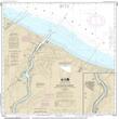
14975 - Duluth-Superior Harbor;Uppers St. Louis River

-
14971 - Keweenaw Bay;L'Anse and Baraga Harbors
-
14863 - Saginaw Bay;Port Austin Harbor;Caseville Harbor;Entrance to Au Sable River;Sebewaing Harbor;Tawas Harbor
-
14815 - Rochester Harbor, including Genessee River to head of navigation
-
14785 - Burlington Harbor