More Pacific Coast ChartsView full List
-
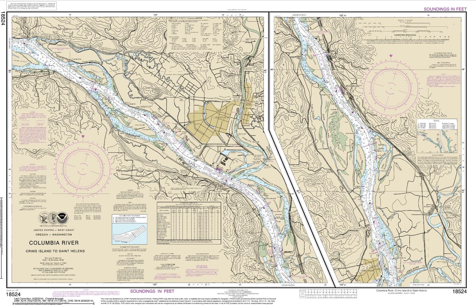
18533 - Columbia River Lake Celilo
-
19480 - Gambia Shoal to Kure Atoll including approaches to the Midway Islands
-
18653 - San Francisco Bay-Angel Island to Point San Pedro
-
81092 - Commonwealth of the Northern Mariana Islands Pagan Island;Plan: Maug Islands
-
19353 - Harbors of Moloka'i Kaunakakai Harbor;Pukoo Harbor;Kamalo Harbor;Kolo Harbor;Lono Harbor